About 132 minutes
A definition of social work: A thesis in sociology — Key Ideas to Explore
Society Culture
30,163 recorded words. 23 minutes difference from this book's estimate.
View Gutenberg source #69557
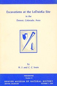
Before opening Excavations at the LoDaisKa Site in the Denver, Colorado area — Background and Themes, the edition data offers a quick orientation: 35,563 words, 2 hr 35 min estimated reading time, and 26 detected text sections.
The text analysis averages about 14.2 words per sentence, while the detected sections provide another way to judge how the source is divided.
Project Gutenberg metadata also associates the work with “Pawnee Indians,” connecting these edition facts with the source record’s subject description.
Explore this collection
These alternatives are selected using recorded categories and estimated reading time.
About 132 minutes
Society Culture
30,163 recorded words. 23 minutes difference from this book's estimate.
View Gutenberg source #69557About 128 minutes
Society Culture
29,360 recorded words. 27 minutes difference from this book's estimate.
View Gutenberg source #37840About 205 minutes
Society Culture
46,982 recorded words. 50 minutes difference from this book's estimate.
View Gutenberg source #43840Search stored excerpts and compare books → Choose by your preferences →
Choices use stored catalog measurements. Estimates vary with reading speed. A shared category is a catalog label, not a claim that two books have the same argument or literary quality.
Search reads excerpt text stored with this catalog and links to its associated Gutenberg record. The connection is stored in the site database; this tool does not recheck that every excerpt is word-for-word identical to that external record. Excerpt search does not cover every chapter and does not verify historical publication dates.
Catalog snapshot checked: 2026-09-26. Coverage: 93 public books, 93 available source excerpts.
Calculated from edition completeness, EPUB availability, text structure and catalogue metadata. Not a user rating.
Total of 100 points, scaled to a 2.5-5.0 range. Editions with an empty description or a missing EPUB file are not scored.
Public-domain source text
The source text is kept in the dedicated reader, separate from this catalogue record and its commentary.
The LoDaisKa site report, published in 1959 as Proceedings No. 8 of the Denver Museum of Natural History, is a collaborative archaeological study by H. T. Irwin and Cynthia Irwin-Williams, with supplementary reports from specialists in pollen analysis, soil chemistry, geology, and paleobotany. The excerpts reveal a work grounded in stratigraphic excavation and laboratory analysis, not a general survey of regional tribes. The catalog subjects list Pawnee and Ute Indians, but the text itself focuses on artifact typology, radiocarbon dating, and environmental reconstruction—particularly the possibility of a Plains route for maize diffusion.
The excavation methodology is described in detail, with samples taken at six-inch intervals from designated squares such as J8 and M11. The pollen analyst, Donald R. Whitehead, notes that preservation was poor except in the lowermost levels, preventing the construction of a pollen diagram. He explains that differential degradation may have destroyed many original pollen constituents, so his results are presented as a preliminary investigation rather than a definitive reconstruction. The text includes technical descriptions of sample preparation—boiling in KOH, washing with HCl, treatment with HF, acetolysis, and mounting in silicone oil—indicating a rigorous laboratory process. This level of methodological detail suggests the report is aimed at professional archaeologists and paleoecologists, not a general audience.
A significant portion of the excerpts addresses the question of how dent corn reached the Fremont area. The authors cite authorities such as Nickerson, Carter, and Anderson who doubted a direct route through Anasazi, Hohokam, or Mogollon regions. They propose a possible route via the Plains, noting that Fremont peoples evidently ranged into areas where dent corn was used. However, the text is cautious: evidence was totally lacking because of the absence of perishables in most Plains sites. The Morrison area provides some support, but the authors conclude that the question must remain open until much more evidence is available. This measured tone contrasts with the catalog's assignment of the work to broad ethnic categories.
The report includes contributions from multiple specialists: Walton C. Galinat on plant remains, Charles B. Hunt on geology, G. Edward Lewis on fauna, Robert J. Rodden on soil chemistry, and Donald R. Whitehead on pollen. The acknowledgments list many prominent archaeologists who provided comments, including Jesse D. Jennings, Richard G. Forbis, and Gordon R. Willey. This interdisciplinary approach reflects mid-20th-century archaeological practice, where environmental data were increasingly integrated with artifact analysis. The excerpts do not describe specific artifacts or features of the LoDaisKa site itself; instead, they emphasize the analytical techniques and the collaborative nature of the research. Readers should expect a technical report rather than a narrative of prehistoric life.
Readers approaching this work should be prepared for a dense, data-rich publication that prioritizes methodology over interpretation. The catalog subjects may imply a focus on specific tribes, but the text itself is concerned with stratigraphy, pollen identification, and the diffusion of maize. The supplementary reports are integral to the main argument, not appendices. For those interested in the history of Plains archaeology or the application of pollen analysis to archaeological sites, this report offers a detailed case study from the late 1950s.
In the LoDaisKa report, I always pause over the layers of pollen and stone—how a place holds its people quietly. It reminds me of another volume, Indians of the Yosemite valley and vicinity Their history, customs and traditions — A Reader’s Guide, where every page feels like that same gentle patience, a landscape speaking in its own time.
Use these questions to collect your thoughts before moving on.