About 71 minutes
The German Element in Brazil Colonies and Dialect — Themes and Context
Social Conditions
16,209 recorded words. 5 minutes difference from this book's estimate.
View Gutenberg source #17361
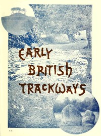
The catalog record for Early British trackways, moats, mounds, camps, and sites — Context and Discussion provides practical reading context through 17,447 words, 1 hr 16 min estimated reading time, and 9 detected text sections.
The text analysis averages about 19.3 words per sentence, while the detected sections provide another way to judge how the source is divided.
Project Gutenberg metadata also associates the work with “Great Britain -- Antiquities,” connecting these edition facts with the source record’s subject description.
Explore this collection
These alternatives are selected using recorded categories and estimated reading time.
About 71 minutes
Social Conditions
16,209 recorded words. 5 minutes difference from this book's estimate.
View Gutenberg source #17361About 71 minutes
Social Conditions
16,222 recorded words. 5 minutes difference from this book's estimate.
View Gutenberg source #69372About 63 minutes
Social Conditions
14,282 recorded words. 13 minutes difference from this book's estimate.
View Gutenberg source #70167Search stored excerpts and compare books → Choose by your preferences →
Choices use stored catalog measurements. Estimates vary with reading speed. A shared category is a catalog label, not a claim that two books have the same argument or literary quality.
Search reads excerpt text stored with this catalog and links to its associated Gutenberg record. The connection is stored in the site database; this tool does not recheck that every excerpt is word-for-word identical to that external record. Excerpt search does not cover every chapter and does not verify historical publication dates.
Catalog snapshot checked: 2026-09-26. Coverage: 93 public books, 93 available source excerpts.
Calculated from edition completeness, EPUB availability, text structure and catalogue metadata. Not a user rating.
Total of 100 points, scaled to a 2.5-5.0 range. Editions with an empty description or a missing EPUB file are not scored.
Public-domain source text
The source text is kept in the dedicated reader, separate from this catalogue record and its commentary.
In Early British Trackways, Moats, Mounds, Camps, and Sites, Alfred Watkins presents a lecture delivered to the Woolhope Naturalists’ Field Club in September 1921, later expanded with illustrations and additional material. The work is not a general survey of British antiquities but a focused argument for a specific prehistoric surveying system: the 'ley.' Watkins defines a ley as a straight line connecting ancient features such as mounds, moats, camps, churches, and natural landmarks, which he believes were deliberately aligned for sighting and trackway purposes.
Watkins draws heavily on his own observations in Herefordshire and the Welsh Marches, using photographs and maps to illustrate his claims. He is careful to frame his conclusions as provisional, stating that 'the notes which follow must be taken rather as suggestions than as final conclusions.' The text combines technical description of sighting points—such as 'mark-stones,' 'earth-cuttings,' and 'water sighting-points'—with speculative etymologies of place names, arguing that suffixes like '-ley,' '-ton,' and '-bury' derive from ley-related features rather than conventional interpretations.
Watkins’s central claim is that ancient Britons used a system of straight alignments, or leys, to link prominent landscape features. He provides examples such as a line running through a pond, Hereford Cathedral tower, and a mountain point twenty miles distant, captured in a telephotograph. He asserts that these alignments were not accidental but deliberate, serving as trackways and sighting lines for navigation and ritual. The ley, he writes, 'was earlier than homesteads, hamlets, or towns,' suggesting that settlements later developed along these pre-existing lines.
Watkins distinguishes between primary and secondary sighting points: primary peaks like Titterstone Clee Hill serve as long-distance markers, while mounds and moats function as local nodes. He notes that 'the exact relation of Roman roads to the earlier leys is a matter for future investigation,' but speculates that Roman surveyors adopted the sighting system while failing to appreciate its long-distance logic. This cautious tone contrasts with his more assertive claims about place names, where he proposes that 'the common suffix—ley—indicates a ley of the character denoted by the first element in the name,' directly challenging the conventional interpretation of 'ley' as 'meadow.'
Watkins relies heavily on visual evidence, including telephotographs that show alignments across miles of terrain. Plate IV, for instance, depicts a line from a gateway near Hafod Hill through a pond to Hereford Cathedral and Pen-y-Beacon. He describes another ley 'crossing the meadow in a straight line just where “the lowing herd winds slowly o’er the lea.”' These images are meant to demonstrate that leys are not abstract constructs but observable patterns in the landscape.
The text also documents specific sites: Castle Tomen in Radnor Forest, described as 'supposed to be the Cruger Castle of the Itinerary of Giraldus'; the Four Stones at New Radnor, where 'the easterly pair lined up for sighting over'; and mounds like Tre-fedw, which aligns with a ford at Llanvihangel Mill. Watkins includes ground-level details, such as a cutting through a ridge at Marstow where 'a bridge now spans it,' indicating how modern features can obscure ancient sightlines. These examples ground his theory in tangible locations, though he acknowledges that the evidence is fragmentary and open to reinterpretation.
A significant portion of the lecture is devoted to reinterpreting place names through the lens of the ley hypothesis. Watkins argues that suffixes like '-ton' originated from 'a mark stone on the ley becoming the nucleus of a homestead,' while '-bury' 'clearly indicates a mound which was a sighting tump.' He cites the example of Trewyn, built on a burial mound and lying on two leys, where a cist with human remains was discovered under a room. This leads him to observe that 'it is a strange development that these tumps were coveted both as places to be buried in and to live on.'
Watkins also connects place names to trade routes, suggesting that 'Gold Hill, Gold Post, or Golden Cross (roads)' derive from meeting points for traders bringing gold ornaments. He notes that there are 'two of each of the above Gold place names in the county,' implying a systematic pattern. However, he admits that his etymological claims are speculative, stating that 'it is no reflection on philologists that, not knowing of the ley, they have made misinterpretations.' This section reveals Watkins’s ambition to synthesize topography, archaeology, and linguistics, even as his methods remain controversial.
Watkins’s lecture is best approached as a period piece of amateur archaeology, rich in local knowledge and personal observation. Readers interested in landscape history or the origins of the ley-line concept will find his detailed site descriptions and photographic records valuable, even if his conclusions are not widely accepted. The text rewards careful attention to his maps and illustrations, which often convey more than the prose. For those new to the subject, it may be useful to read alongside modern critiques of ley theory to contextualize Watkins’s claims within the broader history of British antiquarianism.
That rainy afternoon, Watkins’s careful straight lines across Herefordshire felt less like maps and more like quiet footprints—people who had once looked for the same hills. It made me think of other forgotten reckonings of land, so I found myself wandering into The Aboriginal Population of the North Coast of California — Story, Setting & Ideas, a different shoreline, yet the same patient tracing of presence.
Capture what you thought, learned, and would like to remember.