About 57 minutes
Montezuma Castle National Monument, Arizona (1977) — Themes and Context
Society Culture
12,937 recorded words. 1 minutes difference from this book's estimate.
View Gutenberg source #49607
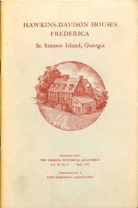
For Hawkins-Davison Houses, Frederica, St. Simons Island, Georgia — Inside the Classic, the stored edition analysis reports 13,267 words, 58 min estimated reading time, and 2 detected text sections.
The text analysis averages about 19.0 words per sentence, while the detected sections provide another way to judge how the source is divided.
Project Gutenberg metadata also associates the work with “Dwellings -- Georgia -- Saint Simons Island,” connecting these edition facts with the source record’s subject description.
Explore this collection
These alternatives are selected using recorded categories and estimated reading time.
About 57 minutes
Society Culture
12,937 recorded words. 1 minutes difference from this book's estimate.
View Gutenberg source #49607About 60 minutes
Society Culture
13,679 recorded words. 2 minutes difference from this book's estimate.
View Gutenberg source #53631About 62 minutes
Society Culture
14,077 recorded words. 4 minutes difference from this book's estimate.
View Gutenberg source #67235Search stored excerpts and compare books → Choose by your preferences →
Choices use stored catalog measurements. Estimates vary with reading speed. A shared category is a catalog label, not a claim that two books have the same argument or literary quality.
Search reads excerpt text stored with this catalog and links to its associated Gutenberg record. The connection is stored in the site database; this tool does not recheck that every excerpt is word-for-word identical to that external record. Excerpt search does not cover every chapter and does not verify historical publication dates.
Catalog snapshot checked: 2026-09-26. Coverage: 93 public books, 93 available source excerpts.
Calculated from edition completeness, EPUB availability, text structure and catalogue metadata. Not a user rating.
Total of 100 points, scaled to a 2.5-5.0 range. Editions with an empty description or a missing EPUB file are not scored.
Public-domain source text
The source text is kept in the dedicated reader, separate from this catalogue record and its commentary.
The catalog subjects for this work—dwellings, Fort Frederica National Monument, and St. Simons Island history—suggest a broad architectural or local-history study. However, the text itself is a tightly focused archaeological report, originally published in The Georgia Historical Quarterly in 1956. It describes the excavation of two adjacent house sites in the abandoned town of Frederica, blending measured floor plans, stratigraphic observations, and documentary evidence. The authors, Margaret Davis Cate and Charles H. Fairbanks, do not offer a general history of the island or the fort; instead, they reconstruct the Hawkins and Davison houses from postholes, brick fragments, and colonial deeds.
The text’s core is a detailed account of digging. The authors describe finding “bottomless barrels” used as well linings, a “tabby floor” later covered by a “brick floor, set with tabby mortar in a herringbone pattern,” and a “double wall” that made the Davison house “drier and warmer” than its neighbor. These physical details are not decorative; they are the primary evidence for the houses’ construction and use. The catalog subject “Dwellings” is accurate, but the work does not survey domestic architecture generally. It treats each foundation, hearth, and trash pit as a document to be read alongside written records.
Fort Frederica appears in the opening paragraphs as the reason the town existed, but the excavation focuses on the town’s residential lots, not the fortification itself. The authors note that the town was “half a hexagon in shape, divided by Talbott Street” into two wards, and that it was “surrounded by a moat” with a “wall of posts ten feet high.” Yet the catalog subject “Fort Frederica National Monument” might mislead a reader expecting a military history. The fort is backdrop; the houses are the stage. The text’s value lies in showing how domestic life was embedded in a fortified settlement, not in describing the fort’s structure or battles.
Cate and Fairbanks constantly cross-reference physical finds with written sources. They cite a remark attributed to Dr. Hawkins that he would sell the Davison children “one to the Carpenter and the other to the Plasterer,” using it to explain the Davison house’s superior insulation. They also mention a “hedge of pomegranates” recorded for Hawkins’s lot and identify a “line of root disturbances” that may mark its location. This interplay between artifact and archive is the work’s real subject, not captured by any single catalog term. The text demonstrates how archaeology can test and amplify historical records, offering a model for studying other “dead towns.”
Readers should approach this work as a technical report, not a narrative history. The authors assume familiarity with colonial Georgia and archaeological methods. Pay attention to the footnotes (indicated by bracketed numbers) and the way each measurement or artifact is tied to a specific lot or document. The text rewards careful reading: a musket bayonet in a well, a stairwell’s extra width, or a fireplace’s altered pilasters all become clues to how two families lived—and quarreled—in a frontier town.
Years among these brittle pages taught me that a house is never just timber and plaster, but a record of daily labors. The Hawkins-Davison homes whisper of hands that swept and sewed. This same quiet persistence lives in the essays of a certain book, where humble acts become their own archaeology. One volume speaks of foundations; the other, remarkably, of the lives that hold them up. Women's Work — Key Ideas to Explore feels like a kindred spirit, shelved closer than one might think.
Use these questions to collect your thoughts before moving on.